

750€ (Including Tax)
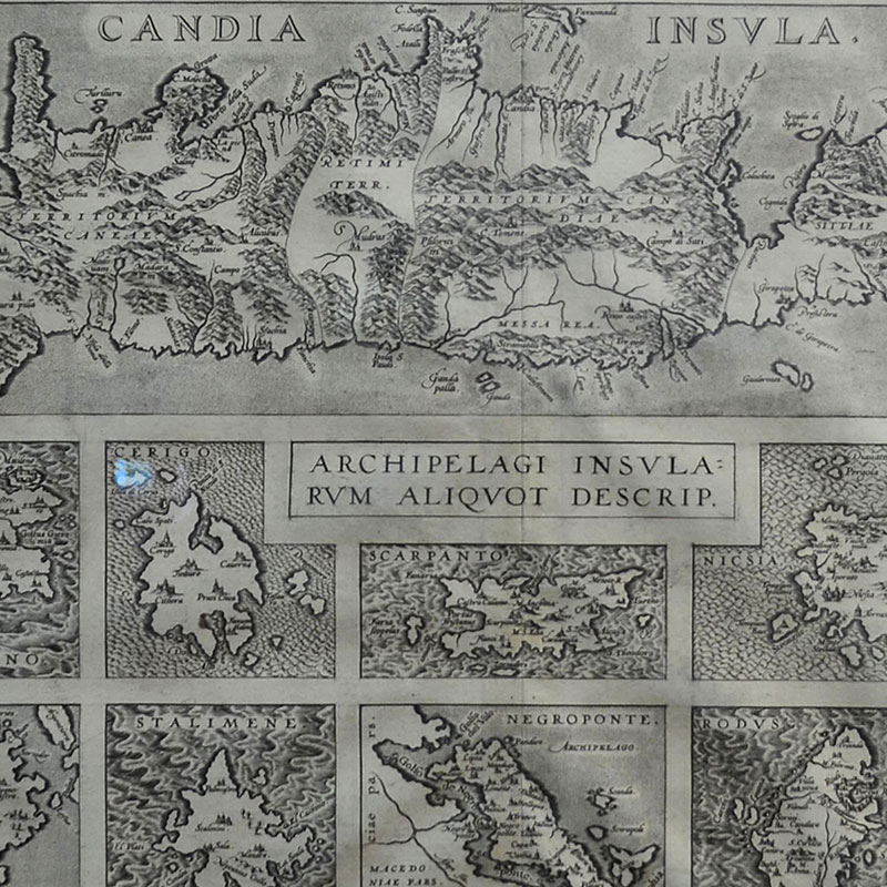
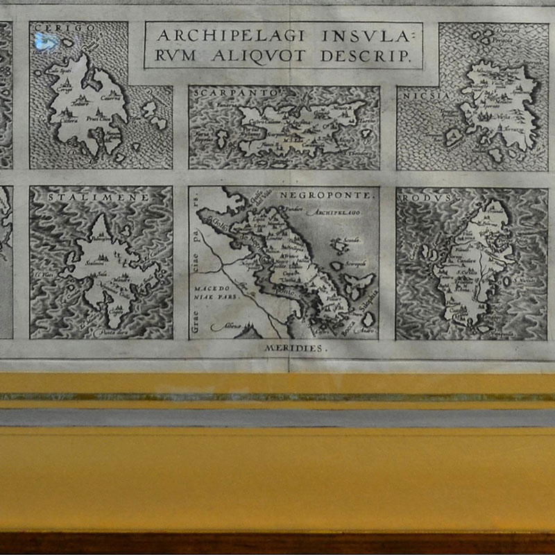
Abraham Ortelius map of Crete with ten additional islands
CANDIA INSVLA, ARCHIPELAGI INSVLA RVM ALIQVOT DESCRIP
Abraham Ortelius map of Crete with ten additional islands.
Abraham Ortelius was Flemish cartographer and geographer recognized as the creator of the first Atlas, the Theatrum Orbis Terrarum.
The map includes the following islands: Metelino (Mitiline), Cerigo (Kithira), Scarpanto (Karpthos), Nicsia (Naxos), Santorini, Milo (Milos), Stalimene (Lemnos), Negroponte (Euboea), Rodus (Rhodos) and Scio (Chios).
Copper engraving, c. 1584
Dimension: 37×52 – 56×68 cm with frame
Condition: Excellent, antique giltwood frame with hand made painted paspartou and silver leaf.
CERTIFICATE
- Certificate of authenticity is provided.
- Please contact us For further information and detailed photos of the items.
- Please contact us for shipping details and cost.
-

English silver cigarette case
360€ (Including Tax) Add to cart -
Sale

English vanity set
Original price was: 350€.300€Current price is: 300€. (Including Tax) Add to cart -
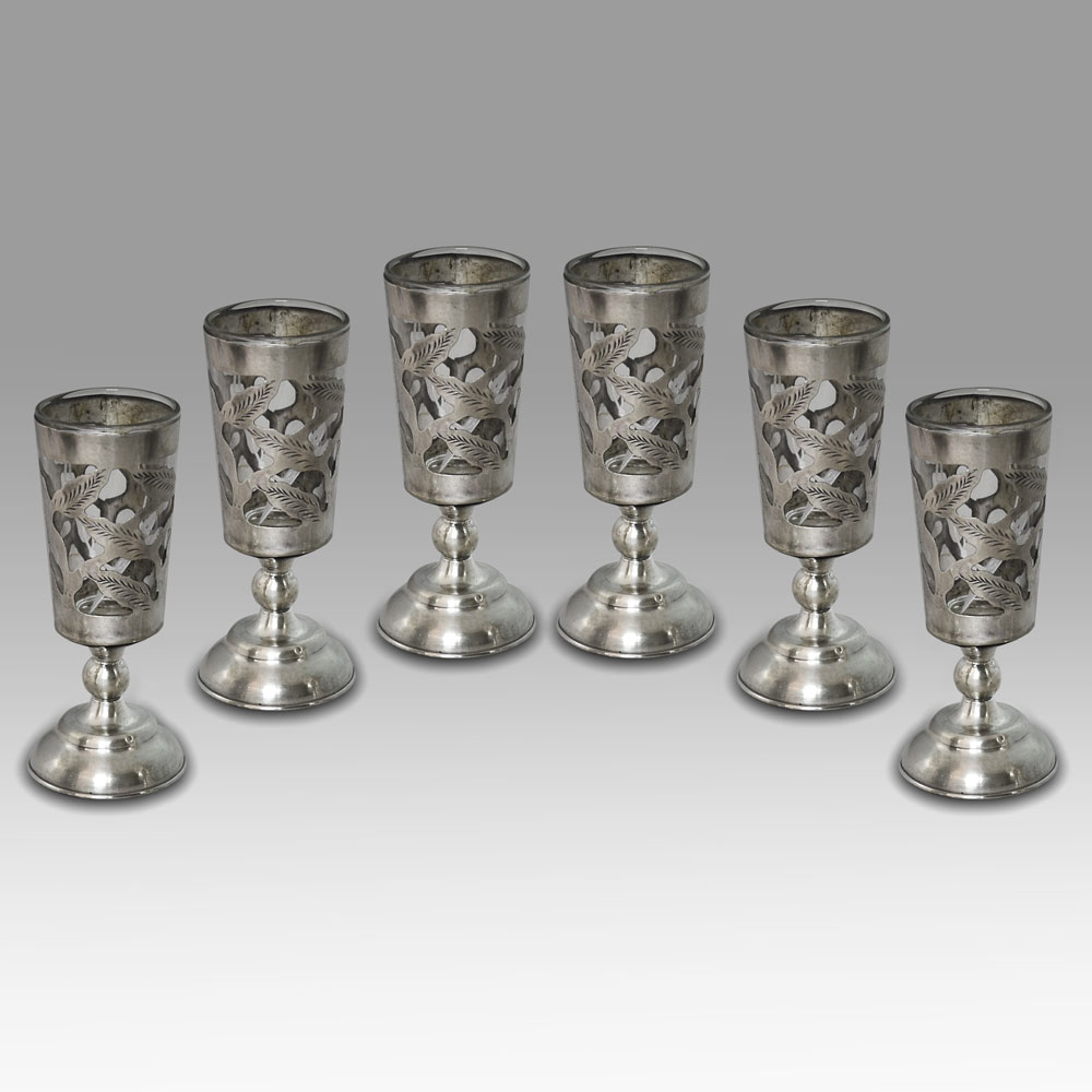
A set of six sterling silver liquor cups
400€ (Including Tax) Add to cart -
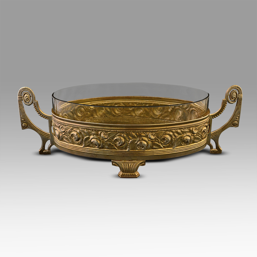
A French Art Nouveau jardinière.
290€ (Including Tax) Add to cart